Google’s new AI tech may know when your house will burn down
Wildfires are becoming an increasingly common threat worldwide. Record-breaking burns from Australia to the Amazon to the United States are devastating the environment. The deadly wildfires that raged across Los Angeles in January were estimated to have caused more than $250 billion in damages.
Current satellite imagery is often low-resolution, infrequently updated, and unable to detect small fires. But what if there was a way to spot wildfires earlier and more accurately before they become raging infernos?
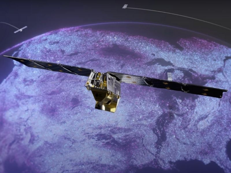
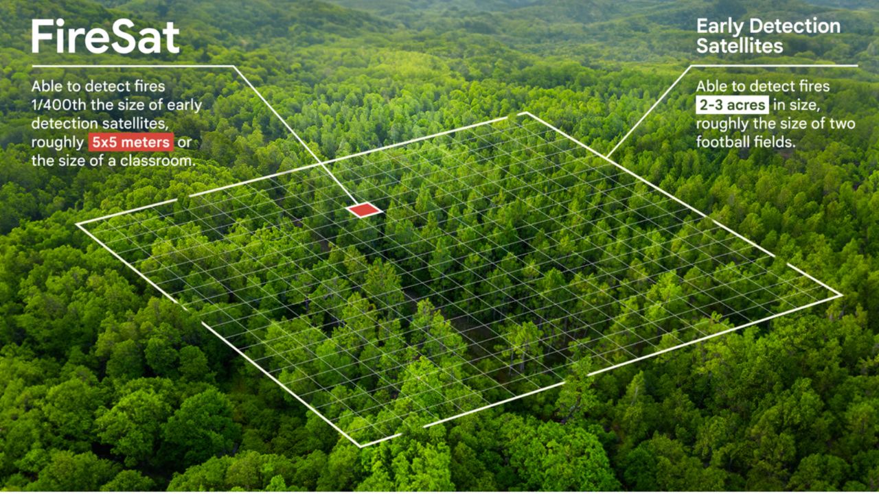
Enter FireSat, a new satellite project designed to detect and track wildfires early. How early? The project aims to detect a fire that’s merely 270 square feet — about the size of a classroom — within 20 minutes. It’s also able to detect fires 2-3 acres in size, roughly the size of two football fields.

Credit: FireSat
Finding fires earlier and more accurately
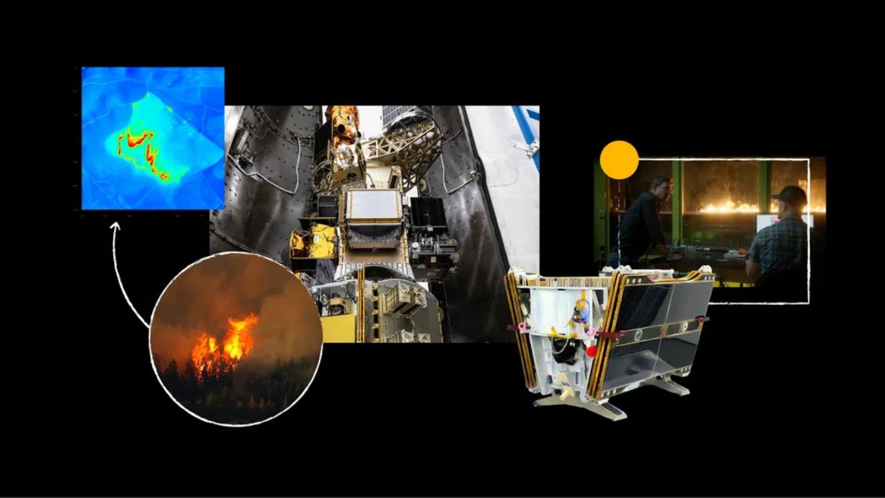
The FireSat constellation will consist of more than 50 satellites when it goes live. The satellites are fitted with custom six-band multispectral infrared cameras designed to capture imagery suitable for machine learning algorithms to accurately identify wildfires – differentiating them from misleading objects like smokestacks.

Credit: FireSat
TOP FIREPROOF BAGS, ORGANIZERS, AND SAFES TO PROTECT YOUR VITAL DOCUMENTS
Building (and testing) a new AI model
Using AI, FireSat rapidly compares a spot — wherever it is in the world — with previous imagery of that location, considering factors like nearby infrastructure and local weather to determine if there’s a fire.
“Differentiating between real fires and random ‘noise’ in the environment was a challenge,” says Chris Van Arsdale, who works on climate and energy projects at Google.
The team even loaded a plane with sensors to experiment with their progress. “The first time we used the plane, one of our team members lit a barbeque and a fire pit in his backyard so we could fly the plane over and test it,” says Erica Brand, one of the project managers for FireSat. “And the sensors were able to pick it up.”
Credit: FireSat
BEST HOME INVENTORY APPS TO PROTECT YOUR PROPERTY IN CASE OF EMERGENCY
FireSat’s long-term vision takes shape
The first FireSat satellite has already been launched. The entire constellation should be in orbit by 2030. The satellite data will contribute to a global historical record of fire spread so scientists can better model and understand wildfire behavior.
Credit: FireSat
BEST APPS TO TRACK AND MONITOR AIR QUALITY TO STAY SAFE
The team behind FireSat
Google Research and satellite manufacturer Muon Space are founding partners in the Earth Fire Alliance, the nonprofit home for FireSat. Funding for the constellation’s first satellite comes in part from AI Collaboratives: Wildfires, an initiative created by Google.org that convenes leading nonprofits, academic institutions, government agencies, and companies around the joint goal of using AI to prevent the devastating impact of wildfires. As part of AI Collaboratives, Google.org provided $13 million to support the launch of the first satellite in the FireSat constellation.

Credit: Earth Fire Alliance
10 ESSENTIAL HOME SAFETY TIPS TO KEEP YOUR LOVED ONES SAFE
Kurt’s key takeaways
So, what does this all mean? It means a future where wildfires are detected faster, contained quicker, and cause less devastation. FireSat represents a major advance in wildfire management. This ambitious project has the potential to protect lives, homes, and the environment we all cherish.
If FireSat had been around during the last major wildfire in your area, how might the outcome have been different? Let us know in the comments below.
FOR MORE OF MY TECH TIPS & SECURITY ALERTS, SUBSCRIBE TO MY FREE CYBERGUY REPORT NEWSLETTER HERE